Trail number
Trail numbering and signage being developed at time of writing.
Trail length
30 kilometres (estimated)
Elevation variance
80 metres
Trail type
Single trail, fire trail
Trail surface
Smooth dirt, rocks and rock outcrops
Weather affected
All weather
Trail condition sources
Refer to Plenty Gorge MTB Facebook page. This is a general forum but you can ask for trail conditions or there may already be some advise on there.
Trail features
Rough natural trails, rock outcrops, views
Trail obstacles
Rock gardens, some obstacles but under ongoing Parks Victoria review currently


Trail rating
Easy and Intermediate
Rating basis
Estimated
Night riding
Yes.
Family Friendly
For more experienced riders.
I have known about this area of trails for quite a few years now but there had been an ongoing debate as to the legality or otherwise of these trails so up until now I have not included them on the website.
Some recent good trail advocacy work on the part of the Plenty Gorge MTB Group has resulted in Parks Victoria and Whittlesea Council giving the go ahead for the use of these trails by MTBers. At the time of writing, track assessment and marking is underway and Parks Victoria are continuing to work with Plenty Gorge MTB Group to get the trails formalised even further.
There is good information on the Plenty Gorge MTB Facebook page in the forum with respect to progress, trail maps and social rides. Look here for a collection of photos on the same Facebook page to give you an idea of the trails. Group website is here.
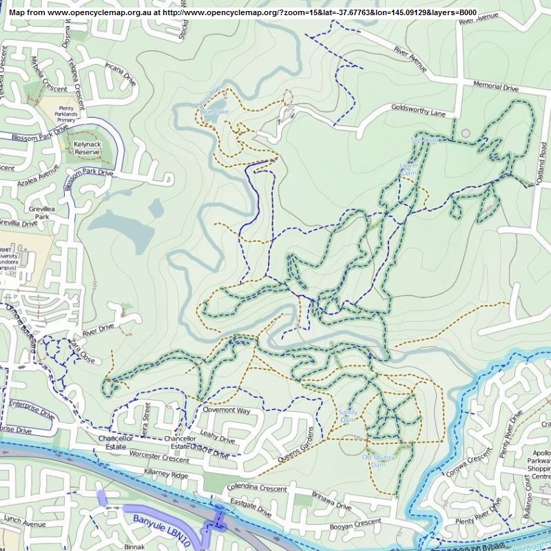
A general map of the area can be located on the Parks Victoria website here. A note on park features can be located here.
Here's another snippet from the Facebook page which gives a status update as of March 2015. Note trail directions in Facebook comment.

Here are five videos from furmanb's You Tube channel to give you a flavour of the trails in the area. This channel also has a number of videos of Lysterfield and Smith's Gully area.
 |
Parking is available at a number of locations. Queens Gardens is one location as described on the Getting There map. |
|---|---|
 |
Toilet facilities are available at Yellow Gum Recreation Area (located in the northern trail area). |
 |
Drinking water is not available. |
 |
No food or drinks are available in the immediate area. |
 |
No local information facilities are available. |